Saturday
Sep032011
the hidden falls
Posted on  Saturday, September 3, 2011
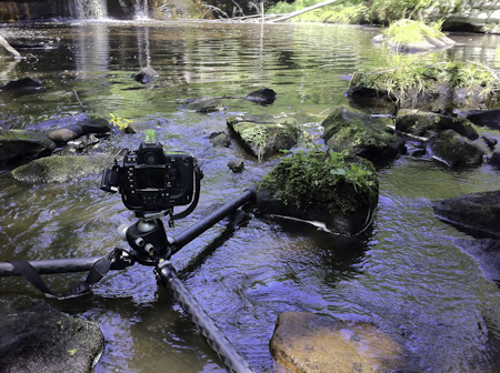
 well, it’s not quite so secret since these falls are clearly marked on the map as Wolf Creek Falls in Banning State Park, MN. When heading out here, I never expected these falls to have this great overhang covered with moss and lichen. I had to get way up under here to get this neat angle.
This was also my first trip trying out my new Spot locator device. You can read about it at the link if you haven’t seen these before and I will say I was really happy with it. Small, and never got in the way clipped to my belt, it kept an accurate track of where I was which I posted a “live” map now on my website header. Pretty cool!
Find it here: 46°8’47” N; 92°51’39” W