find me at:
Twitter Facebook Google+ RSS
Strava Activity

Wednesday
Sep142011

pray for rain


i like photographing trees that seem to be out there all by themselves doing their own thing (i’m sure you could psychoanalyze that) so when i got to Arches National Park, this tree on the shoulder of Balanced Rock caught my eye.  i only had one day to spend in this park but it was a great day with moody clouds and rain passing through.  this place is definately on my list to get back to again, hopefully for a few days and at least one overnight in the park to photograph the stars.

Find it here:  38°42’4” N;  109°33’53” W

Saturday
Sep032011

the hidden falls

well, it’s not quite so secret since these falls are clearly marked on the map as Wolf Creek Falls in Banning State Park, MN.  When heading out here, I never expected these falls to have this great overhang covered with moss and lichen.  I had to get way up under here to get this neat angle.

This was also my first trip trying out my new Spot locator device.  You can read about it at the link if you haven’t seen these before and I will say I was really happy with it.  Small, and never got in the way clipped to my belt, it kept an accurate track of where I was which I posted a “live” map now on my website header.  Pretty cool!

Find it here:  46°8’47” N;  92°51’39” W

Monday
Aug292011

this old house

I used to live in the Sierras, Mammoth Lakes to be exact for the winter season of 97-98.  The house we (me and 4 roommates) lived in was pretty rough.  A basic A-frame with no insulation between you and the roof - just exposed rafters, roof board, and shingles on top of that.  Heat was from a little wood burning stove in the corner which wasn’t too effective since we always seemed to have ice in the bathroom or kitchen.  Hey, I’m not complaining, it was cheap ($700/mo split 5 ways), I had a season pass, snowboarded everyday, and there was a sh*tload of snow but it was cold enough that you often had to sleep in your snowpants to stay warm!

Well that place had nothing on this one. This is one of two small abandoned buildings just off CA-395 north of the June Lake junction.  A big wide open valley with great views of the Sierras, I can see why someone would live here, but it must have been tough in the winter in a building like this, even when it was in good condition… 

Find it here:  37°53’57” N;  119°5’39” W

Monday
Aug292011

Delicate Arch in the sun

Up today, is a different view of Delicate Arch in Arches National Park.  I snapped this while waiting for sunset.  Before I published it here, it was neat to see that someone grabbed it from my Flickr stream and posted it to their blog called Heck Yeah Utah!  You can check that out by clicking here.  There are some cool photos there to see.

Find it here:  38°44’37” N;  109°29’57” W

Saturday
Aug272011

a small creek flows here

Driving along CA-41 (Wawona Hwy) in Yosemite, you cross several small creeks that you really wouldn’t otherwise notice except for the small brown signs on the side of the road. Alder Creek is one of those and this is just a few hundred feet down from the road. If you are coming in through from the Oakhurst side entrance, be on the lookout for it a bit before you get to the Wawona tunnel. Whether you go up or down the creek from the road, you won’t be disappointed.

Find it here:  37°34’47” N;  119°40’43” W


Friday
Aug192011

not yet swept away

Taken just below Wolf Creek Falls in Banning State Park, MN.  It’s a neat little park roughly 90 mi north of Minneapolis.  Just a 1/2mi walk to the creek and falls, it feels very secluded, with growth right up to and over the water.  While up on the falls, I noticed these yellow flowers just down stream so I made my way down there quickly to capture them before they got swept down the creek.

Find it here:  46°8’48” N;  92°51’40” W


By the way, here is a picture I took while getting this shot:

Thursday
Aug182011

the downward spiral...


Took this one evening while exploring the Mission Inn in downtown Riverside. There is a lot to explore here, walking in to the lobby, you would never know that there were many winding, narrow hallways and passages that snake through the complex leading from one interesting room/area to the next.

Find it here:  33°59’1” N;  117°22’23” W

Monday
Aug152011

the long fall


It’s been a while since I’ve gotten around to adding a new post here.  You know, life/work (mostly work) get in the way.                                                                        
This is the first photo I’m uploading from our trip to Yosemite.  While the weather was beautiful, it wasn’t really nice for taking pictures - there didn’t seem to be a cloud in the sky for the entire time we were up in the Sierras, not even a hint of those great afternoon thunderstorms that seem to build there.  Anyway, any trip to Yosemite is a great one and what’s a trip to Yosemite without a stop at Glacier Point.  This view of Upper Yosemite Falls from across the valley and used a 10 stop ND filter to smooth out the water.  Often at this time in the year, the falls (especially this one) have slowed to a trickle but with all the snowpack from the season, they were still flowing strong.
Wednesday
Jul202011

Delicate Arch


This is the first image I’m posting from the bunch I took at Arches National Park in the spring. This thing is unbelievable - Delicate Arch sits precariously at the edge of a nearly vertical drop thousands of feet to the canyon below seemingly not much between standing and tipping over and be gone forever. When you walk around it, it’s really hard to believe that it actually formed where it did. This whole park makes the time frame that we occupy our short lives here seem even shorter. There are arches (throughout the park) in various stages of formation and destruction and it really gives you the feeling that our planet is dynamic, not just on our time scale but on something so much larger and almost incomprehensible.

While I was here waiting for sunset and twilight, there were probably 100 other photographers and park visitors waiting with me. Funnily, one other photographer remarked to me “with so many others (photographers) taking photos, we won’t be able to sell these for much…” I smiled politely and chuckled, really laughing at what seemed to be his motivation for being there rather.

Find it here:  38°44’38” N;  109°29’57” W

Wednesday
Jul202011

Gooseberry Falls

This area is about an hour north of of Duluth on the shore of Lake Superior. Since the state of Minnesota was closed, this park area was closed too, but you could just park on the road and it was a short walk to the falls.  I never realized that this part of Minnesota had so many cliffs and bluffs - I’m looking forward to exploring this part of the state more now that I’m living here.

Find it here:  47°8’34” N;  91°28’3” W

Tuesday
Jul192011

a dragonfly descends with just a whisper

somewhere through a thousand blues a dragonfly descends with just a whisper I’m lonelier than god….

I couldn’t get that out of my head while I was at this spot. This was along the shores of Lake Superior north of Duluth, no one was around and it was eerily quite for a Saturday afternoon.  I was walking along the rocky shore when I noticed this one area had hundreds of dragonflies going in and out of a nearby thicket. I had my Nikkor 200mm f4 Micro in the car so I went back to get it and grab some macro shots.  The title came from a song by the band HUM.  Have you heard of them? If not you should really check out some their songs, great lyrics that will fill your head with creative visions.

Find it here:  46°56’4” N;  91°48’21” W

Wednesday
Jul062011

a brilliant sunset in Utah

Finally getting some time to get through the many photos I’ve been taking over the past few months.  This one was taken along I-70 on my way moving from California to Minneapolis.  I really like driving through this part of the country, its very scenic and it seems like there is never a bad sunset.

Find it here:  38°50’12” N;  111°6’7” W

Monday
Jul042011

stars glow at the dark lighthouse

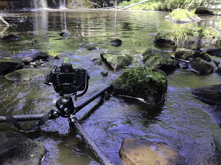
I spent some time this holiday weekend exploring my new state of Minnesota and took a drive up to Duluth and Lake Superior.  I planned on spending the day in Duluth, but just kept driving north along the western shore of Lake Superior stopping along the way to take some photos.  State Highway 61 hugs the shore all along the way, passing through a few small towns.  My plan was to make it to Split Rock state park (and lighthouse) by sunset so I spent some time in Two Harbors checking out the steel agate loading docks, and Gooseberry Falls a little further North.

I got to Split Rock Lighthouse State Park just before sunset, then realized that today the Minnesota government shut down (couldn’t reach a budget agreement) so the state parks were closed too.  The entry road was under construction, and since there wasn’t really a gate (just some cones and a wooden barrier), I pulled over on the side of the road and hiked in.  It was probably a little more than a mile walk through the park and down to the bottom of the cliff to get to the vantage point here.  I got here just as the last of the sunlight was striking the lighthouse and cliff.  With the park closed down and no one else there, it was amazingly serene and peaceful.  The only sound was the water gently washing up against the rocks.  I took some photos but even with the great light, there were no clouds which would have made it even better.  Being so clear and not windy, I decided to stay until it go dark enough to photograph the stars with the silhouette of the lighthouse in the background.  It was roughly 7:30pm and using the VelaClock iPhone app, I figured I had to wait until at least 10:45 to get past nautical twilight and it would be dark enough so I just sat on the rocks and watched the light fade listening to the splashing water.

Next trip, I’m looking forward to getting all the way up to the Canadian border and later hopefully to travel the south/eastern portion of the lake in Wisconsin to the Apostle Islands (but may need a kayak for that).

Find it here:  47°12’0” N;  91°22’6” W

Friday
Jun172011

spread your wings

Have you been to the 17 Mile Drive on the California coast just south of the Monterey/Carmel area?  It’s quite beautiful and everyone should go there if they have the chance.  The drive starts just south of Monterey and winds it’s way through the golf resort of Pebble Beach.  There are neat pull outs all along the drive but you have to pay $12 for the privilege of entering the private road but in return you get a map that calls out the pull out and scenic areas which humorously sometimes tries a little too hard to be creative in comeing up with a description for the pull outs.

This stand of trees is just south of the Lone Cypress.  Have you seen the Lone Cypress?  If you are a fan of golf (I’m not), you would recognize it as the tree logo for the Pebble Beach golf course.  Well, leave it to the wonderful lawyers to try to take people to court to stop them from photographing, painting, drawing, whatever of this beautiful landmark.  Ha, read more about that here and here.

Find it here:  36°33’44” N;  121°57’19” W

Monday
Jun132011

the empire glows red

Spring is the best time of year in Southern California.  There’s still snow in the mountains, neat cold storms still rolling through, and the hills are still green before the summer’s scorching heat “burns’ everything to the same shade of brown. This was taken during my last trip up into Sycamore Canyon before moving to Minneapolis and I miss it already.

Find it here:  33°57’0” N;  117°18’56” W

Tuesday
May102011

Arches National Park

Yesterday I started my drive from Southern California to Minneapolis for my new job there. The last few weeks leading up to today have been unbelievably crazy, not just with moving things but it seems like more and more “things” started coming up as I got closer to May 9th (both work and personal that I can’t share here). But yesterday as I started driving, it all seem to dissolve away as the miles ticked by. It’s easy to forget what a vast and utterly beautiful country we live in when you’re stuck in the daily grind. I’ve been lucky to get to see almost all of it driving from here to there and back over the last 20 years. I’d much rather spend a few days driving than deal with the “convenience” of flying and all the “precautions” that come with it. It’s really kind of sad that it seems the days of family road trips are over. Very few people I talk to these days do that. With gas prices what they are, it might actually be cheaper to fly from here to there, but what you miss is what in between. The “in between” is beautiful - the rolling hills, farmland, mountains, abandoned buildings from long ago, and not to mention sunrise and sunset.
So back to my move - part of my job relocation includes expenses paid moving of my things and shipping of my vehicles. I could have just jumped on a plane and show up at my new home - rather, I chose to go see what’s in between…

Delicate Arch, Arches National Park, UT

Saturday
Apr092011

Pigeon Point Lighthouse

It’s a beautiful drive up the Pacific Coast Highway along the California coast from Monterey to San Francisco.  This particular weekend, it was rainy with nice dark moody clouds, deep green hillsides, and misty fog sitting in the low areas in between.  It seems like there almost isn’t a bad spot to stop and take a picture along the way.

Find it here:  37°10’60” N;  122°23’23” W

Sunday
Apr032011

could life be better?

This is near Big Pine, California along CA-395.  There was beautiful, warm light coming through the Owens Valley from the setting sun.

Sunday
Apr032011

just a horse

On a nice sunny afternoon driving back from Mammoth along CA 395 we came upon these friendly guys so we stopped to say hi.
Saturday
Mar262011

Arch Rock - Joshua Tree National Park

This is Arch Rock in Joshua Tree National Park.  It’s just a short 0.3mi walk off the White Tank Campground parking area.  This area is very rocky and I was out in the complete darkness (it was new Moon) for about 2 hours.  I kept freaking myself out thinking I was hearing a mountain lion wandering around out there with me - not that there was, I was just being a chicken, ha ha. 
Taken about a hour after sunset, 2min 50sec exposure.  The bright cluster of stars in the center is the Pleiades and just below that is Taurus and  the star Aldebaran.

I’d like to get back out there sometime soon and find an angle to capture the Milky Way in the background and maybe try out some light painting.

Find it here:   33°59’10” N;  116°0’56” W